


Arabic version: صور الأقمار الصناعية تكشف عن أضرار واسعة في جنوب لبنان
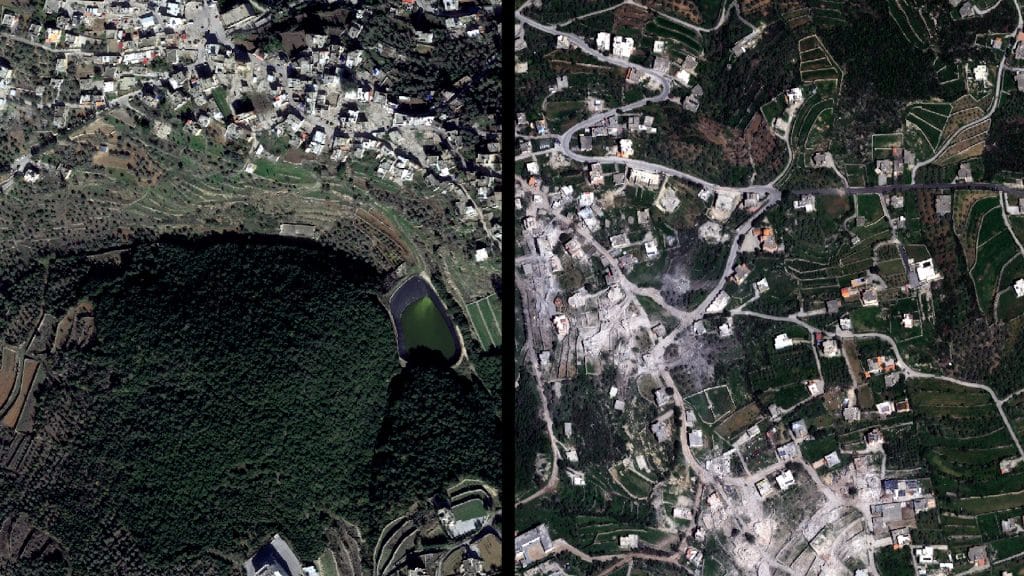
Satellite images taken on April 16 reveal the massive scale of damage to the towns of al-Qozah and Beit Lif in south Lebanon, following the Israeli military’s ground invasion and sustained attacks on the south.
According to Al Jazeera, the images depict a significant scale of devastation, showcasing the impact of military operations on civilian infrastructure and residential areas.
The situation in southern Lebanon continues to evolve as the Israeli military maintains its presence and operations in the area, leading to concerns regarding humanitarian conditions and the safety of local residents.
The release of these satellite images has drawn attention to the ongoing conflict and its repercussions on communities in Lebanon, raising questions about future stability in the region.